Cartography and Geomatics Portfolio
This is a portfolio of various cartographic products I have produced for school assignments, work tasks, and personal projects that I pursued for learning or for fun.
 United Counties of Leeds and Grenville
Software: ArcGIS Pro
Personal
This topographic map illustrates the geography of these united counties. I built this map from scratch, generating the hillshade, built-up areas, and labels myself.
 Regional transit in Skåne County, Sweden
Software: Inkscape
Personal
A schematic-sctyle map of major regional public transit service in a region of southern Sweden.
 Critical Habitat of the Snuffbox (Epioblasma triquetra)
Software: ArcGIS Pro
Work: Fisheries and Oceans Canada
This is an example of a map created by a custom ArcGIS Pro toolbox I developed in Python and Arcade. The map template I developed is automatically filled and set up to the input dataset, adhering to departmental style guidelines.
 The Lost Villages
Software: ArcGIS Pro, Inkscape
Personal
This map shows the changes that have taken place in the landscape surrounding part of the St. Lawrence River between historical topographic maps and the current day.
Software: ArcGIS Pro
Personal
This map illustrates the accessibility of public transit in the southern Ottawa neighbourhood of Riverside South. I built a custom, comprehensive pedestrian network dataset to create this. The building data was extracted from OpenStreetMap—note that it is subject to certain limitations, such as condominium buildings weighted equally to single-family homes.
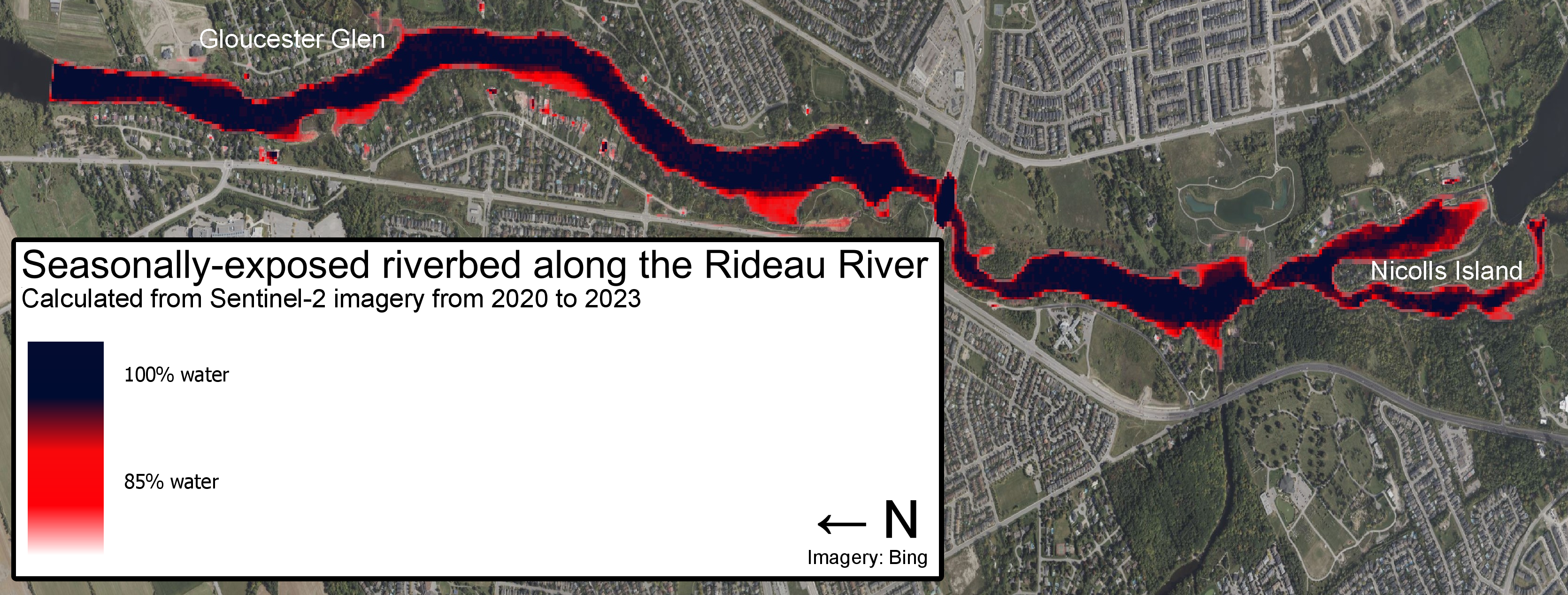 Seasonally-exposed riverbed along the Rideau River
Software: Google Earth Engine, QGIS
School: GEG3105 Earth Observation
Using Google Earth Engine through its Python package, I developed a methodology that maps areas of a waterbody that are seasonally exposed as water levels fluctuate. It is based on automatically-delinated water using a modified Normalized Difference Water Index for Sentinel-2 imagery. The result is visualized in QGIS.
 New protected areas and OECMs within Boreal Caribou ranges in Canada
Software: ArcGIS Pro
Work: Environment and Climate Change Canada
A map of new protected areas and other effective area-based conservation measures within the range of the Boreal Caribou in Quebec added to the Canadian Protected and Conserved Areas Database.
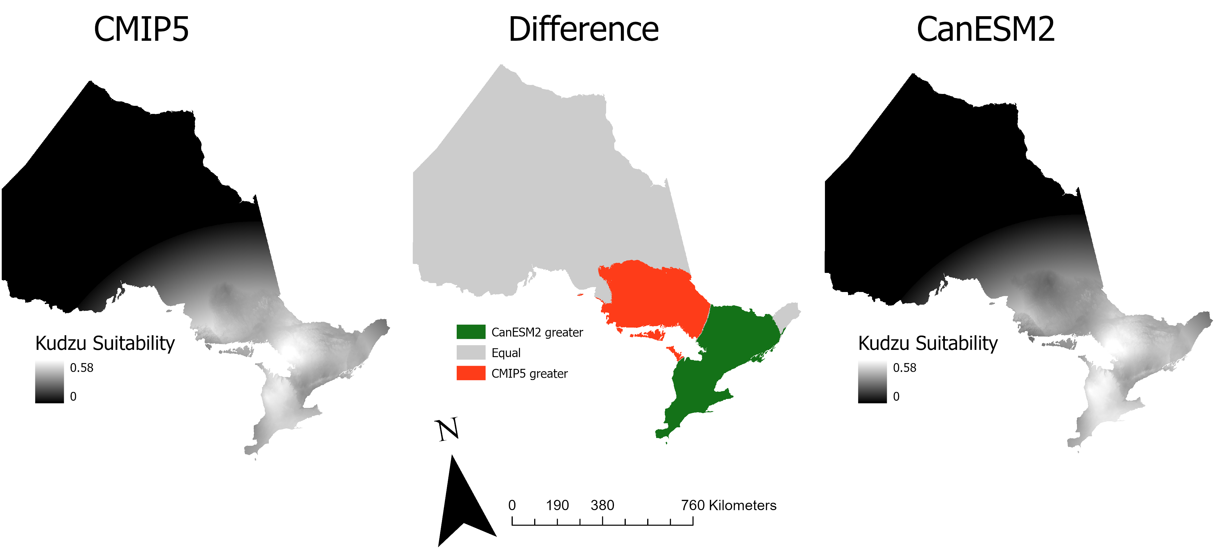 Kudzu suitability
Software: ArcGIS Pro
School: GEG3312 Digital Earth Analysis & Modelling
In this map, I predict the suitability for invasion by the devastating invasive plant Kudzu (Pueraria montana) in Ontario based on different climate change models.
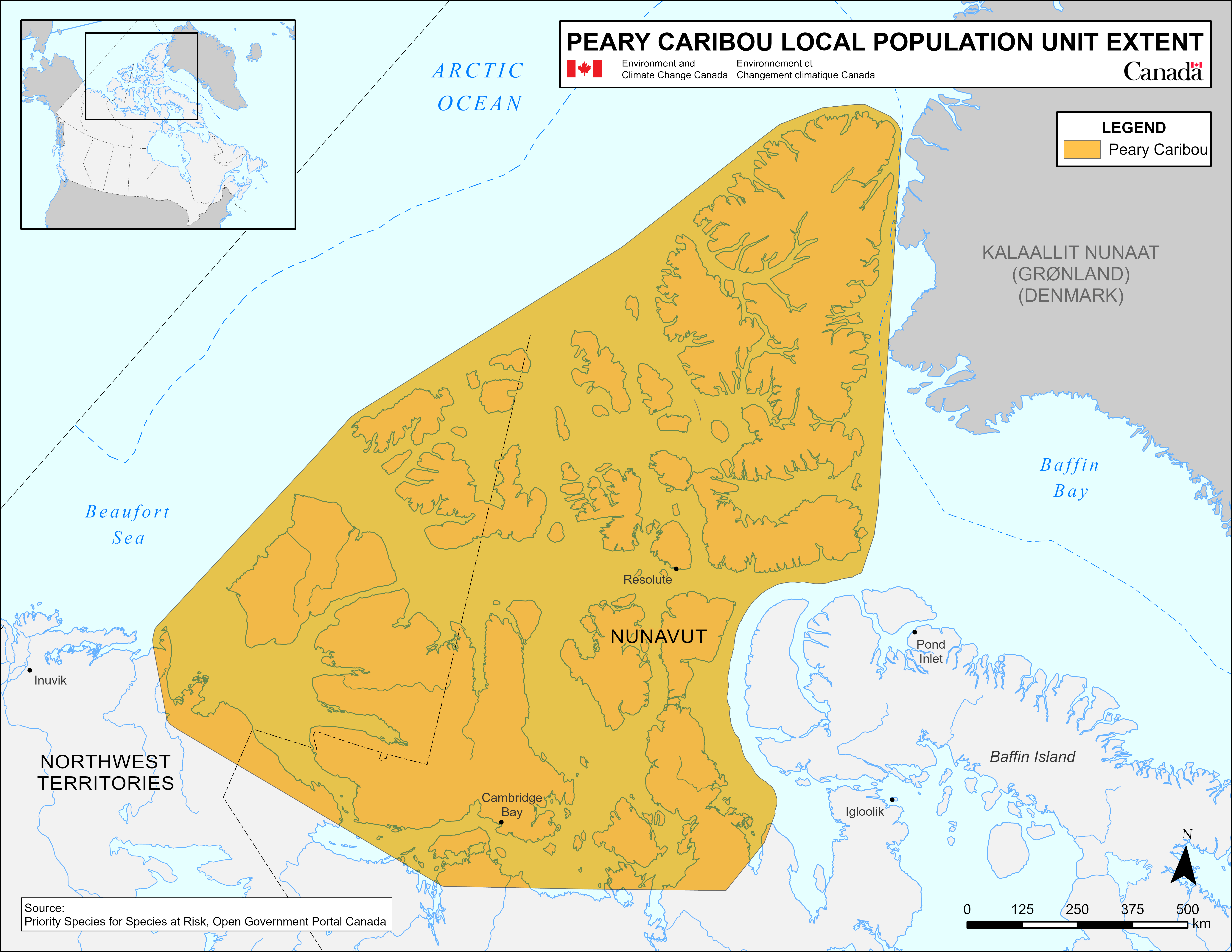 Peary Caribou local population unit extent
Software: ArcGIS Pro
Work: Environment and Climate Change Canada
This map delineates the extent of the Peary Caribou local population unit, as part of the Priority Species initiative. This map is designed to conform with departmental style standards.
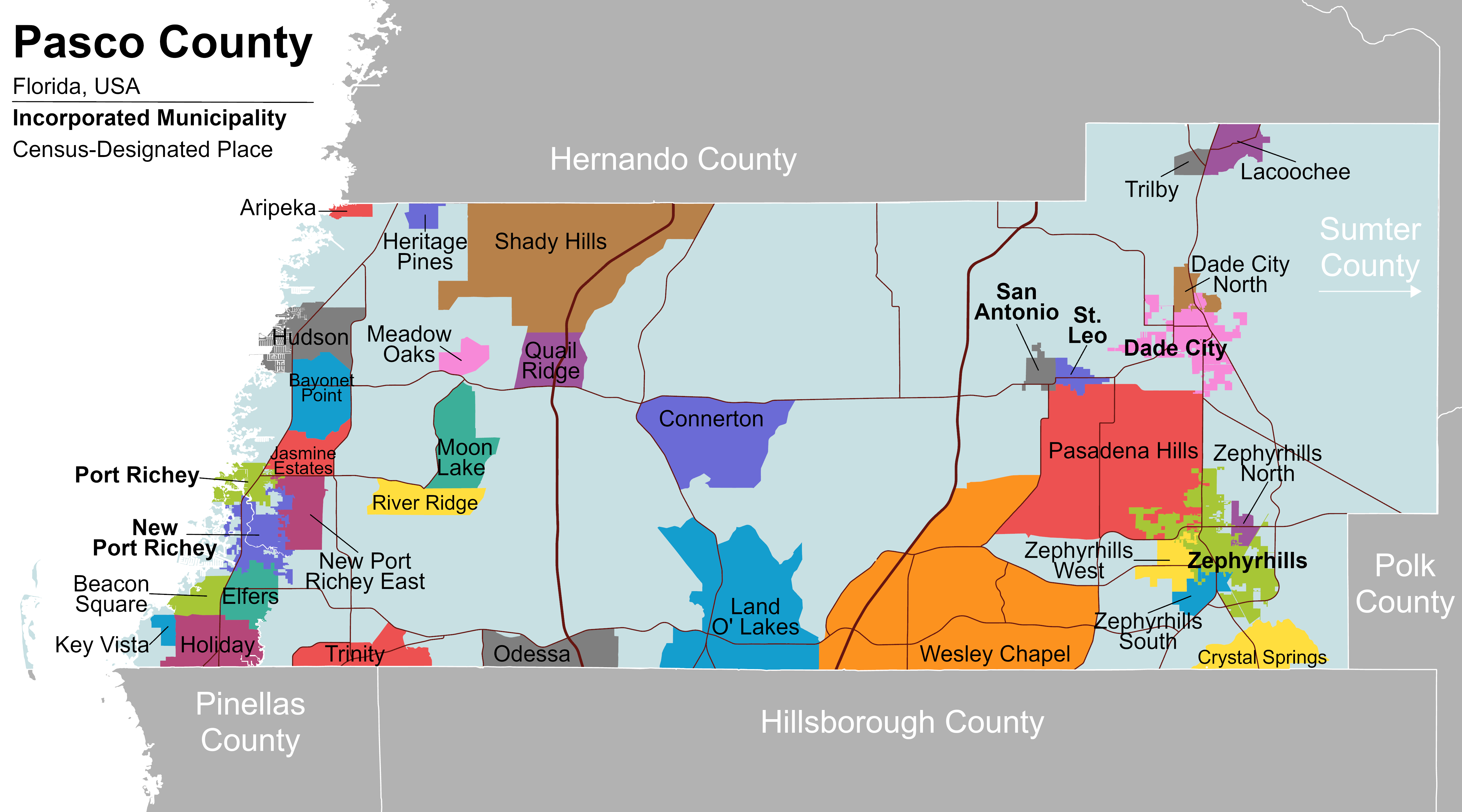 Subdivisions of Pasco County
Software: ArcGIS Pro
Personal project
This map shows the boundaries of incorporated municipalities and census-designated places in a county in Florida, USA using a colourblind-friendly colour palette.
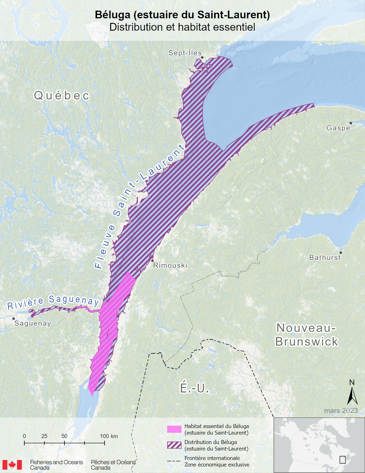 Distribution and essential habitat of the Beluga (St-Lawrence Estuary) DU
Software: ArcGIS Pro
Work: Fisheries and Oceans Canada
This map is part of a series of maps developed for an internal interdepartmental request.
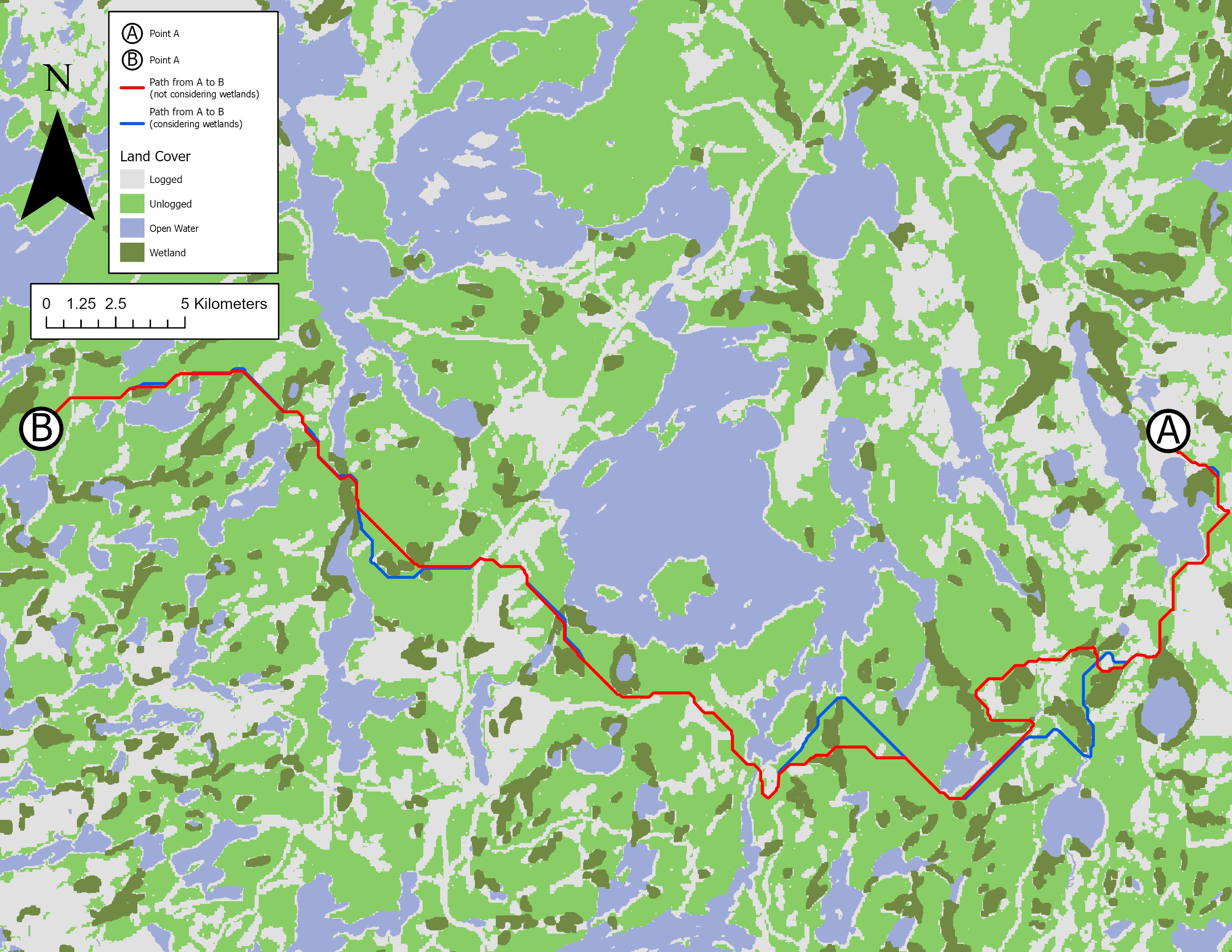 Least-cost paths
Software: ArcGIS Pro
School: GEG3312 Digital Earth Analysis & Modelling
This map demonstrates calculated least-cost paths between two points based on predetermined costs assigned to different land cover types.
Software: ArcGIS Pro
Personal
This is a map of the regional bus transit network in the Outaouais region of Quebec. The entire map was built in ArcGIS Pro, including the basemap and labels.